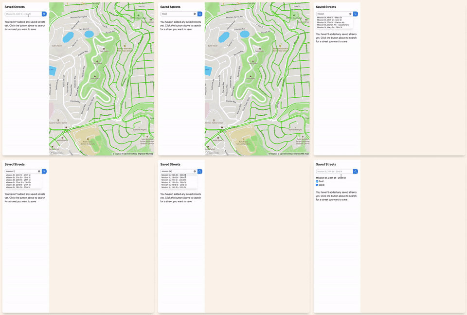
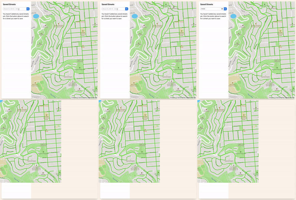
Thanks for the suggestion - I don’t think this solves my issue though. I had originally attempted the datalist method for autosuggest that you linked, but I didn’t like how the browser rendered it so I went for my own markup ¯\_(ツ)_/¯
Side note: this line in the heex is really useful! I had no idea you could add a binary flag with the {elixir code} syntax (I thought it had to be attr={elixir code})
<input type="text" name="q" value={@query} list="matches" placeholder="Search..." {%{readonly: @loading}}/>
I can provide more code though, which probably is helpful 
FullMap hook:
FullMap: {
        mounted() {
            this.map = new Mapper();
            this.map.initMap('full-map');
            this.handleEvent('street-data', (payload) => {
                geojson = {
                    'type': 'FeatureCollection',
                    'features': payload.data.map(street => {
                        const { geometry, ...properties } = street
                        return {
                            type: 'Feature',
                            geometry: geometry,
                            properties: properties
                        }
                    })
                }
                this.map.addStreets(geojson, payload.sector_id)
            });
            this.handleEvent('update-streets', (_payload) => {
                this.map.clearStreets()
            })
            window.addEventListener('zoom-to', (e) => {
                this.map.zoom(e.detail)
            })
            this.map.registerMapEvent('load', () => { this.pushEvent('load-data', { bounds: this.map.mapBounds() }) });
            this.map.registerMapEvent('moveend', () => { this.pushEvent('load-data', { bounds: this.map.mapBounds() }) });
        }
    },
and the Mapper class:
class Mapper {

    constructor() {
        this.map = null;
    }

    initMap(container_id) {
        mapboxgl.accessToken = document.getElementById(container_id).dataset.apiKey;
        this.map = new mapboxgl.Map({
            container: container_id,
            style: 'mapbox://styles/mapbox/streets-v11',
            center: [-122.438434, 37.769397],
            zoom: 15,
            maxBounds: [
                [-122.66336, 37.652987], // Southwest coordinates
                [-122.250481, 37.851651] // Northeast coordinates
            ],
            minZoom: 13
        });
    }

    registerMapEvent(event, fun) {
        this.map.on(event, fun);
    }

    mapBounds() {
        return this.map.getBounds().toArray();
    }

    clearStreets() {
        if (this.map.getSource('sweep-streets') != undefined) {
            this.map.removeLayer('sweep-streets')
            this.map.removeSource('sweep-streets')
        }
    }

    zoom(geometry) {
        const bounds = new mapboxgl.LngLatBounds(geometry.coordinates[0], geometry.coordinates[0]);
        for (const coord of geometry.coordinates) {
            bounds.extend(coord);
        }
        this.map.fitBounds(bounds, { padding: 20 });
    }

    addStreets(geojson) {
        var geojson_source = this.map.getSource('sweep-streets')

        if (geojson_source == undefined) {
            this.map.addSource('sweep-streets', {
                type: 'geojson',
                data: geojson
            });

            this.map.addLayer({
                id: 'sweep-streets',
                type: 'line',
                source: `sweep-streets`,
                layout: {
                    'line-join': 'round',
                    'line-cap': 'round'
                },
                paint: {
                    'line-color': ['get', 'color', ['at', 0, ['get', 'sweeps']]],
                    'line-width': 3,
                }
            });

            const popup = new mapboxgl.Popup({
                closeButton: false,
                closeOnClick: false
            });

            this.map.on('mouseenter', 'sweep-streets', (e) => {
                this.map.getCanvas().style.cursor = 'pointer';

                const coordinates = e.lngLat;
                const properties = e.features[0].properties;
                const sweeps = JSON.parse(properties.sweeps)

                const html = `<div>
                                <h1 class="font-bold text-lg">${properties.corridor}</h1>
                                <div class="flex"><p class="flex-1">${properties.limits}</p><p class="mr-2">${properties.block_side}</p></div>
                                <p>Next street sweeping is <b>${formatDay(sweeps[0].next)}</b> from <b>${formatHour(sweeps[0].from_hour)}</b> to <b>${formatHour(sweeps[0].to_hour)}</b>.</p>
                            </div>`

                popup.setLngLat(coordinates).setHTML(html).addTo(this.map);
            });

            this.map.on('mouseleave', 'sweep-streets', () => {
                this.map.getCanvas().style.cursor = '';
                popup.remove();
            });

        } else {
            var new_features = geojson_source._data.features.concat(geojson.features);
            geojson_source.setData({ type: "FeatureCollection", features: new_features });
        }
    }
};


